After spending a month and 3 days in Pahrump, the balmy 80F temperatures had slipped to the low 70’s, the nights were getting rather coolish in the low 40’s, but down in Mexico San Felipe’s weather was getting comfortable. So…it was time to head down to San Felipe. Too far to attempt in one day from Pahrump, so I’ll stop over in El Centro before crossing. There are several RV parks in El Centro and I like to stop there a few nights before I cross the border to take care of last minute details. On this particular trip, I just planned on spending 3 nights, mostly to check out a Passport America park, Rio Bend RV & Golf Resort where I might play some golf. The amenities were interesting, what with the on site golf course, snack bar, event restaurant, pool, library, and an open air bar. Plenty of room to ride my bike. From their web site, looked like my kind of place.
First had to get to El Centro soooo…check out this map. I chose to take the easterly route. It shows it’s a 6 hour trip and I want it to be a leisurely drive so I planned on it taking 8 hours. Did nearly all my pre-trip check list late afternoon the day before travel. Stowed everything except the electric cord, even hooked up the car and stowed my bike. Got up at 6 and was driving out of the RV park at 7. I also needed to stop for diesel and scouted out stations in Pahrump the day before. Decided on the station at the casino just up the street from the RV park. Turned out that was a mistake because there at the pump their card computer system is set so that I ended up having to walk into the store to pay, than go back out to pump, go back in to pay, back out to pump. Three pump and three pay cycles all because the owners are too cheap to upgrade. Stay away from the 76 Station at the Gold Town casino in Pahrump if you’re driving a big RV and need lots of fuel. And NO, I’m not going to leave my card inside, not after having my info stolen at a 76 station in Rosamond and someone charged $8,000 on my card within 3 days. My bank caught it in time and reversed all the charges on it 3 days later…but that is why I only use a credit card to buy fuel and never leave it with the attendant unless I’ve been going there for years and recognize them. Using a debit card, consumers have no recourse if money is stolen. What I didn’t understand about that whole stolen card info situation is that the bad actor tried to pay an $8,000 restaurant bill over on the California coast. What I was told by my bank is that first the card showed up later that same day I’d filled up in Rosamond up in Stockton where someone used the numbers from my card to fill a large SUV’s fuel tank (that’s what tipped off the CC company that it was likely fraudulent, how did I get there so fast?). Two days later the thief was down at the Cali coast and had a very large party with numerous guests at a large restaurant AND somehow tried to order and pay for restaurant equipment?? Wild. Likely the owner or manager of the restaurant paying for many of his or her friends to have a night out at a nice restaurant on him, that charge went through, and then went wild ordering equipment for the restaurant. I had to chuckle at the thought of the bad guy suddenly having ALL those charges reversed, where he worked, or even at a place he owned. Around $8,000 in reversed charges as fraudulent. My thinking was that he’d gotten the VISA card number from a friend up in Stockton, and the guy in Stockton was paying the guy in Rosamond for it. Hopefully they all were arrested.
So had a bad experience at 7 am while getting tanked up, but once on the road by 7:30, my mood changed back to happy. Weather was a bit chilly and that’s why I’m leaving Pahrump. Note the hill way off in the distance, will be passing that in a few minutes.
 And soon, I’m near those hills. This is where the highway makes a sweeping turn east towards Las Vegas. But I noticed something. There’s a long trail of dust hanging in the air just above the ground, just below that hill. What could that be? It continued off to the right out of frame too. Looked to be 3-4 miles long.
  Closer now and this very long cloud was still a curiosity. Hanging there in the gentle sky over a 3-4 mile swath of desert. It was strange and attracted my attention. So I watched it for several miles trying to figure out what it was from. Early morning mist from a stream or creek? A bunch of farm vehicles traveling a dusty road? A lone truck moving fast? A high speed attempt to get to work on time? Industrial effluent from some mining company processing ore? All these things crossed my mind…
As I got closer to the mist, it really reminded me of the mist you see over a creek or river in the early morning. I decided that must be it. Until I got to a cross road that seemed to head in that direction. And there sitting around 50 feet from the main highway was a white, late model SUV with it’s hood open, and with small clouds of steam emanating from the engine compartment. Small like it didn’t have much water left. HAH! So it appears that the car was belching steam for those 3-4 miles and stopped only when the engine seized up, or they finally noticed the temp gauge, or they felt they were close enough to a main road to get help. I kept moving because I didn’t think I could get my RV towing a car in there where I’d still be able to get back on the highway easily.
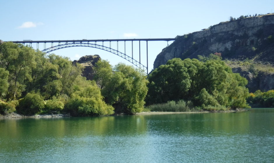
Well, whatever, after that excitement, I was soon in the foothills. And not much later was on the outskirts of Vegas.
 The GPS map route kept me to the south of the city so I’d see large stretches of land like this…
  This is just two lanes of a four lane freeway outside of LV. Lots of empty ground outside of town.
  There is a large solar farm over there somewhere. Lost in the haze.

 Well, whatever, I lost it somewhere. But the scenery was interesting. Especially since it was not very hot.
Just a few miles from where US95 ‘T’s with I-40 are these dunes. On the day I passed through, there were hundreds of people here riding their dune buggies around. There was a small tent city set up with commercial booths, a couple of dry camping area with hundreds of RVs. Although these pictures don’t show many vehicles, I saw and heard lots of dune buggies roaring around the dunes near the road. Sometimes it was really loud, but all the buggies were where I couldn’t see them. I should have stopped for the night. Why not?
 This is all sand left over after the inland sea that use to occupy the middle of the US dried up and drained.
  Another of the RV dry camps. This one was official with government signs and what not.
 And 40 odd miles south of that area, along the Colorado River, some date farms.
  And at around 4:30, all set up at the Rio Bend RV & Golf Resort. Made pretty good time on the road. Notice the nice tree I have there for shade. It was in the high 80’s here in El Centro. But the mornings and late afternoon were very comfortable during my stay.
  So here in El Centro, I prepared to cross the border into Mexico. Removed and stored the front license plate from my vehicles, signed up for Mexican insurance with Lewis & Lewis, notified my Credit Union I would be crossing the border…typical travel stuff. I’m heading to San Felipe again this winter. It’s only a 2 hour drive from El Centro, and I know which RV park I’m heading for, no reservations needed because SF has many RV parks. This trip though, I’m going to cross over at the Mexicali East crossing. It’s suppose to be more suited for RVs. I’ve always crossed into Mexico from here using the Mexicali West and that’s not a bad crossing, but I wanted to try something new. Meanwhile, I’m going to enjoy my visit here at the Rio Bend RV park for a few days.
Nice park. The sites are gravel, I missed having a picnic table, services are fine and well placed. Wifi was OK for the basic stuff, banking, surfing, etc. I did get all parked and hooked up when I noticed that the flowering bushes on the drivers side interfered with the living room slide. So had to unhook and move the RV over a couple feet. Even then, I could not open the basement compartments during my stay with the slide extended because of the bushes. Lots of park models, many for sale, scattered around mixed with the RV spaces. There’s a section where there are large pull through spaces for RVs but I used my Passport America card and it’s not accepted for the pull through sites. With the card it’s $25/night for a maximum of 3 nights and I paid to stay all three. I arrived several days before Thanksgiving. My first full day here I’d gone shopping and tried to find a turkey I could cook in my slow cooker but no luck. Needs to be 6 lbs or less. But it turned out the RV park was going to have a Tday dinner. Cost was $15. Or I could just wait and do something down in San Felipe.
  The offices and activity rooms. The water tower was interesting, not really sure if it’s used anymore.
  Hidden by the wall on the left is the open air bar. There’s the pool, the spa, and behind and next to the spa is an area with many tables set up for dining. They might have intended to have a restaurant here at one time, but it probably didn’t get enough business so it’s only used for special events now. I did notice they use workampers here. Older people who work as service people for the park to get something taken off their rent. Both bartenders and the waitresses were all workampers. (Except on T-Day, but I’ll get to that later).
 So here I am overlooking the golf course from near the water tower. Nice looking course.
  Well cared for grounds. Everywhere I looked practically, beautiful flowers or flowering bushes.
  The man made lake. RV spaces would be on the right, manufactured homes are on the left.
  And here’s the ‘New River’. The RV park is situated overlooking a large bend in its course and that’s where they got the name for the park. It looks like I could just easily walk down there, but this is a telephoto shot, so it would be a longer hike than I’d want to do. Where I’m taking this picture is about the same height as that other flat area on the other side so the river is down in a valley.
 Quite the river at one time to have made this large of a river channel. Back during the Ice Age and a few thousand years after. Those days are gone now. Off in the distance is farm land.
This RV park is 8 miles from El Centro so there’s just a smattering of small businesses in the area. Mostly it’s farms. One small grocery store, more like a convenience store, a couple miles north from here. But it does have a diesel pump with easy access for large RVs. I’m going to need that when I leave. That’s Mexico off in the distance towards the south.
  Here’s the library and event building. I stumbled onto a Ice Cream Social here accidentally at around 2 in the afternoon after having ridden my bike for at least an hour. Whoa, did they load up my bowl! Had a banana split, great ice cream, with all the toppings. Haven’t had one of those in years, more than a decade, perhaps two. Yum. I’d forgotten how good a banana split is.
 And a bit more of the golf course.
  That man made lake (water tower shown earlier would be to the left in this picture) sits between these pull though spaces for RVs, and those permanent manufactured homes in the background.
  I checked, this park model was going for $27,000. There’s several like it for sale around the park. The park has a sales office for the dwellings they own outright, or those they sell on consignment, but there are also FSBO (For Sale By Owner) homes. Slightly better prices. Many retirees buy these places as their winter homes. It is right on a golf course after all, and the weather is mostly fine. What you don’t see though, is the summer’s scorching heat. This park is likely empty during the summer.
  So that’s it for now. It turned out that it was so nice here, I decided to extend my stay so eventually ended up staying a week. They have specials for first time visitors…4 nights for the price of 3. Cost was $150 for 4 more nights. So I ended up paying $225 for a weeks visit here. Worth it. Only wished I’d played a round of golf. Next time.
Thanks for visiting!
Enjoy your time in San Felipe! You can still cross SOUTH at Mexicali West in an RV, however when returning NORTH you MUST cross at Mexicali East. With the realignment work going on at the west crossing it cannot easily accept RVs, fifth wheel, trailers, etc.
Thanks, Jeff! I intend to!
What, a week of glamping and no golf? Hope you had a good T-day meal. And ice cream? And a couple of brews.
You picked the route I would have gone. Back in the 1980s I took the Amboy shortcut between I-40 and I-10 a couple of times. Hauling new trucks. There used to be a salt lake to the west right along the road. And some interesting mineral buildups. But according to present pictures that’s all gone. And way off route for you.
Ole! Have an enjoyable and safe trip to S.F., Mexico.
Yeah, golfing! I know! What’s wrong with me? Tell ya what though, I’d get up early in the morning, and think about lugging my bag and clubs clear over to the clubhouse and soon I’d be doing social media on the computer instead, and pretty soon after that it would be too hot to golf. Bah! But now I have found a golf hand cart so I won’t be able to use that excuse again. Yeah, I could have just driven over there but…
Amboy? Nope, never been there. Wow, that’s the middle of nowhere.
Looks awesome. Hoping to head down that way soon. Do you go farther south than san felipe?
If you’ve checked out older portions of my blog, you’ll see that I’ve been RV’ing all over Mexico for years. Thousands of miles. Back and forth, up and down.
But, no, I’ve never been further south in the Baja than San Felipe, except for some day excursions in the car. Reason was that originally during my first trip to SF, I learned that the last 25 miles of the trip south (or 25 klicks, can’t remember which) on Mx-5 just before it joins with Mx-1 was mostly gravel, rutted, huge potholes, long stretches of washboard road and generally in very bad shape, and to go that route would be very bad on any RV. I’d have to backtrack north, than cross over to the west coast highway all just to head south. And than 3 years ago, the first winter I visited Baja, a bad storm ripped out a large section of the coast highway (Mx-1) and dropped it into the sea. Took them months and months to get it back into operation. And several months after they’d finished, a long time La Paz visitor tried the new road and said it was improperly made and the blacktop was so thin that after just one winter it was already too potholed for his 5th wheel. And the return trip using the graveled Mx-5 was no thrill either. Dangerous to equipment. He said it was so bad now that from now on he was traveling down to Mazatlan and taking the ferry across to La Paz.
So, with those considerations…applying only to the Baja peninsula mind you…I’ve cut my travel to the south of Baja short and only gone to SF the last few years. Someday though…
Just learned some good news…that 25 mile section that was in such bad shape has had some work done on it and now (Jan. 2018) it’s been graveled in many areas. Still needs work, but it’s in better shape now than it was. Not sure I’d want to test it myself but someone may.