By 8am, we were passing through Spokane, Dan had wanted to stop here and go to a couple Brew pubs he’d read about but I refused as punishment for him forcing me to make trip changes that prevented me from visiting Oroville, Washington, where four years before I had been thinking of buying a bar. Decided to travel instead as the siren song of the road was louder then that of owning a bar. But I still had wanted to visit that area. Sounded interesting.

Spokane. I can't see any reason to stop. Can you?

An hour later and we are on the Columbia Plateau. That's Sprague Lake over there.
Note the dirt brown tinged with yellow color of the hills and roadside. This is a desert in the late summer but with water provided by the Columbia Valley Water District, there are hundreds of thousands of acres of wheat grown around this area. It doesn’t need much water if there are rains in the spring or a blanket of snow in winter.
Spokane is only 40 minutes from Couer d’Alene and leaving the city and traveling a few miles we turn south and head down to the Tri-Cities, Washington. Kennewick, Pasco, & Richland. Richland is where the Hanford Nuclear Reservation is. The Columbia passes by all three towns. This is where Dan & I grew up. First a few months in Pasco, where my first memories kick in at age 2, then the family moved over to Kennewick. Eventually, the folks bought a house in Kennewick. We went to grade school there, then started high school. Finally, we moved to Walla Walla, which is only 45 miles from Pasco, because it’s cooler in the summer, milder in the winter with less wind, and much less dusty. Less of a desert. After returning from the Navy and Viet Nam, I went to college in Pasco while living in Kennewick. Crossing over the ‘New Bridge’ everyday (it’s now the ‘Old Bridge’ since the oldest bridge was torn down a few years back and replaced with the ‘New New Bridge’). Confusing I know. There are 3 bridges across the Columbia in the tri-cities now. When we first moved there, there was only one. And it was old then, and too narrow. A harrowing experience to travel across it at speed later at night with a drunk headed your way. Everyone hated that damn bridge and there were always people getting killed on it. Lots of crashes over the years. It was like it was designed for model T size cars. The ‘New Bridge’ was a life saver, but a pedestrian design. Only it’s color made it attractive. But it was an excellent short cut for me to get to college.
As a comparison, the ‘New New Bridge’ is spectacular. Very well designed suspension bridge that’s almost a work of art. Or is a work of art. After the ‘New Bridge’ went up, people in the communities complained of how plain it was and that drove the state department of transportation to take bids for a design of a bridge that had more, what, flair? shall we say? And the engineers accomplished that. So when the ‘old bridge’ was finally torn down, much to the communities relief, the ‘new new bridge’ that rose up to take it’s place was such an eye appealing pleasure by comparison that the communities revere that bridge. And that appeal is exactly why I took so many pictures. Because I have a history with it. A love story really.
That and the fact that we grew up playing under and around the old bridge where the new new bridge now stands. The old wooden (fire trap) several story high grain elevator where we use to climb (or rather Dan did) is gone, and the Bridgeview Inn where my folks use to spend so many hours is gone, the trailer park where we lived close to the tavern is gone, but we remember where they were.

Off in the distance is one of the best designed bridges on earth. Here in Washington. Crosses the Columbia between Kennewick and Pasco.

And here we go.

Then we parked on Treasure Island to get some better shots.
Treasure Island use to be an old military outpost. During WWII, Hanford was where the nuclear project was going on. They made the second bomb here. It was finally deeded to the city a few years ago and it’s been converted into a condo, brew pub, shopping center. Not really an island as it’s connected to Kennewick with a dry road built on a dike.

That's Rattle Snake Mountain way off in the distance. I just turned around (from the last shot) to get this picture. There's my RV, resting.

The old 'New Bridge'. We called it that for years, before the newer one was built.
Near the New Bridge, just beyond, on the Kennewick side, is a city park named Columbia Park. That’s where they have the super heavyweight hydroplane races every year now on the Columbia. First kind of race I was ever at where one of the drivers was killed. I’ve seen people get killed on TV at Nascar races but this was the first time in person. I saw the crash, the hydroplane hit a large wave and jumped up out of the water, flipping over on top of the driver. He was knocked unconscious by hitting the water and drown before they could get him out. I remember seeing them hoist the boat out of the water and up onto the shore while emergency crew were trying to revive the guy. We in the crowd weren’t told much about it by staff but I could see the grief of the family down in the boat pits so it was obvious he didn’t make it, and the paper confirmed that the next day. But the races went on.
Originally, there was a pit mine there at the site of present day Columbia Park where a rock company mined gravel. There was a hundred foot deep hole there, about 1/4 mile in diameter. It was right alongside the river practically so the deeper it got, the harder it was to keep the pit pumped out. In heavy rains or heavy run off, it would fill up so fast they couldn’t mine it for months. Finally, it cost them to much to maintain so they donated the land to the city. The city needed a big community park along the river so they accepted it. They spent a year creating a nice park with tables, grassy areas, play areas, sports fields, shoreline picnic areas, etc. But the crown jewel was the pit. They filled it up with whatever rocks and soil they could find so it was just ended up at 12-14 feet deep (I think, I can’t remember for sure).
I can’t find an online picture of the pond as it was being filled and remade into a swimming hole. When I was a kid they called this a swimming hole but now it’s called a Family Fishing Pond. There’s a fountain in the pond, probably to get air into the water to prevent green slime. There was (is?) a channel cut between the pond and the Columbia River. This was used to flood the pond after they had it all clean and everything. We were all pretty excited about swimming there. I don’t know if my folks knew something we didn’t or not but they kind of hesitated to take us early on. I am pretty sure it opened late spring but we didn’t go until late summer. In any case we finally went to the pond and had so much fun that the folks started taking us every weekend and sometimes mom would take us on weekday afternoons. There use to be a floating dock out from the shore a ways and dad had an old rubber raft (that we had to continuously pump up), so there was always plenty to do there and lots of fun to be had.
It wasn’t until decades later that I found that our government decided to use the pond as a radioactive test site. What they did was criminal, and the contractors that helped knew that. Their plan was to release radioactive materials into the Columbia, (the Hanford nuclear facilities are upstream of the Columbia Park by just a few miles), that coincided with the opening of the channel that would flood the pond. They even disguised employees with civilian clothes and gave them Geiger counters hidden in coolers. They walked along the shoreline in various places along the route of the radioactive release measuring how the radioactivity negotiated the route. And how it accumulated in the environment. Since the opening to the pit would siphon off a huge amount of water from the Columbia, they wanted to see what course and concentration the radioactive element took or had as it followed the water into the pond. So, there were these guys dressed like civilians, carrying coolers, who would stop occasionally alongside the Columbia or the channel into the pond and surreptitiously measure the radioactivity.
This pond was widely known to soon be a playground for kids! Including my family. Years later, when this became known because of the Freedom of Information Act, the city demanded a test of the pond, and sure enough, the silt at the bottom of the pond was contaminated. I don’t know what happened, if the city made the contractor that ran the test clean it up or not but I do know they don’t recommend people swim there now, and it’s called a ‘Family Fishing Pond’ instead of a Swimming hole. Though I wonder how safe eating fish from there would be. Our government experimenting with it’s young citizens. Certainly not the first time, nor the last I’d recon.

I zoomed in the lense for this shot.
This is the New Bridge, it has a very nice color that is to be admired, blue, when most bridges of the era are green, but the structural design is pedestrian, average, dull. It’s the New New Bridge that draws your eye to it and holds your interest. The newest bridge in the area, between Richland and Pasco, is really dull. I didn’t even take a picture of it. Perhaps it’s because the river isn’t very wide there. It’s one of those bridges without a superstructure. Just railings along the roadway about 4′ high. You do get a pretty good view of the river, but when you’re driving, that shouldn’t matter anyway since you should be concentrating on the road ahead.

Not a bad shot. The Columbia is over a mile wide here.
The corp put in dikes along side the Columbia here to hem it in. Can you imagine if you were living here hundreds of years ago and needed to get across? As kids, we thought about that all the time. Fast flowing, wide, dangerous currents and eddy’s.
We had a dog that use to follow us all the time, seemed especially fond of going to the river. We never figured out why, but she use to pace back and forth along the bank while looking at something on the other side. Or so it seemed because try as we might, we could never spot whatever it was that made her so agitated. This went on for nearly a year, each time we went to the river but we never let her jump into the water. Finally, we just decided to let her go after whatever it was. It was a Saturday morning and we let her jump into the river and head for the Pasco side. She wasn’t very big, the river was more then a half mile wide, and we lost sight of her soon after she started across. So we wandered off and did what we did on a nice Saturday. Late that afternoon we returned, saw her on the other side of the river running back and forth for some reason. We called out to her and sat on the dike waiting. Around an hour later here she comes. Dog tired as they say, but none the worse for wear. We didn’t let her jump in the water again after that, and she didn’t seem that interested anymore either.
The Columbia Park where the hydroplane races are held? I believe that is the site where Kennewick man was found. I know I walked up and down that stretch of beach a hundred times. Loved to walk along the water. I might have walked on the dude, there alongside the river, under scant inches of mud and sand. There were some reports by the scientist involved that he was found in Finley, but my family also use to go there for picnics all the time preceding Columbia park and we wandered up and down that beach too. So where ever he was hiding, I probably walked on him. Even if it was the beach across the river in Burbank. Since he was found in such a populated area, I’m sure there were some lies told about where he was found to prevent a ‘bone rush’.

Then I swing around and get this shot of the 'NEW NEW Bridge'. Quite the work of art, I'd say.
The New New Bridge (West Bridge) and the New Bridge (East Bridge) are 6 miles apart. They both connect Kennewick and Pasco.

Much more stylish then the bridge this replaced.
There in the background (picture directly above) is the old railroad bridge. As little kids, 3 & 5, Dan and I would try to cross that bridge but it was really scary. Not much room for little kids and a giant train. Anyway, we practiced going out a couple hundred feet and running back many times until we felt ready. Then we talked our friends into coming with us. Our dog Gypsy decided to come along. Usually we left her at home. Naturally, the day we decided to cross, we were around half way, here comes a train from the Pasco side. Blowing it’s horn wildly while we all high tailed it back to Kennewick. We saw we wouldn’t make it so at the last piling we all shimmied off the bridge. Gypsy couldn’t shimmy so she laid down between the tracks. I couldn’t see what was going on but Dan told me she stayed down for the whole train but it must have gotten relatively quiet near the caboose because she raised her head to look and the cabooses rear axle got her in the back of the head. She was still alive while we carried her back home. Mom rushed her to the vet, but she didn’t make it.

Another random shot.

Here's the house Dan & I grew up in. The trees are much bigger now.

Here's the carport we use to jump off of trying to brake a leg.

The grade school we went to. Bethleham Lutheran. K-9. We attended 5th through 9th.

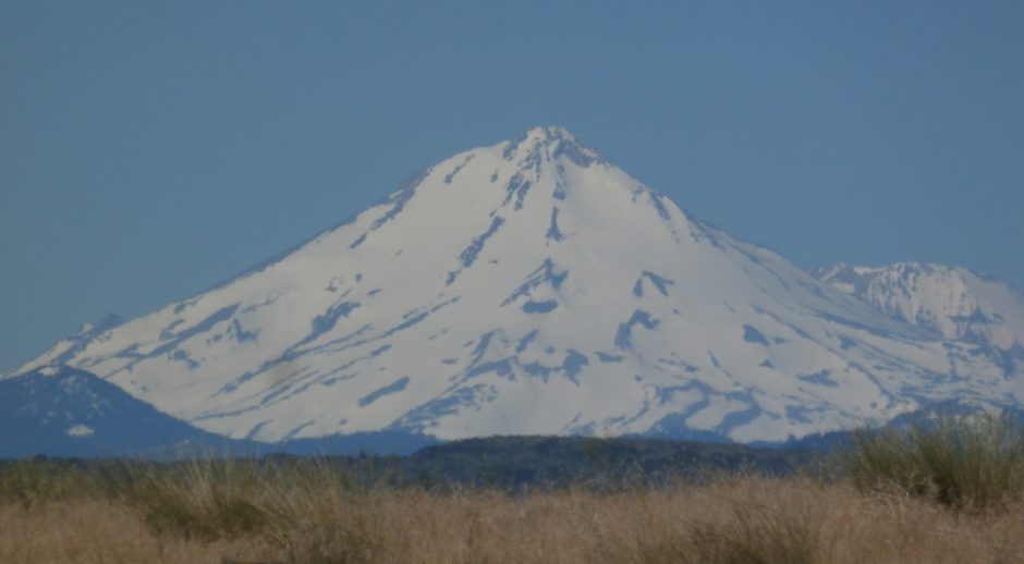
Off in the distance is the Boise Cascade paper mill in Wallula where our dad worked for many years as an oiler. Yeah, my dad walked around every day oiling big machines. Not quite that simple of course.

The 'Gap'. The Columbia River has been squeezing through there for millenia.
Forty minutes later we arrive in Walla Walla. Planing on an afternoon brew pub beer, we attempt to drive downtown. Only to find that the streets are blocked off, just like we found in Pasco earlier in the day. So, after wandering around trying to find someplace big enough to park the rig, we finally get to downtown and find that they are having a street fair…almost over, but there are still many antique autos parked on the street.

We arrive in Walla Walla. The downtown streets are all blocked off and they are having an auto show on the streets.

Fancy.

Cool.

Nice.

Lots of work there.

Excellent condition. Good ol' VW Bus. Lots of people lost their virginity in these things.

And the inside.

One of the few art galleries in town.
What’s remarkable about ol’ Walla Walla is not so much the art galleries, there aren’t many, but rather the wineries. There are 125 wineries within shouting distance of Walla Walla. Amazing. With wine you would expect there to be lots of artists and galleries, the two seem to go hand in hand. But that isn’t the case here. The do have a robust theatrical group here though. While in Walla Walla, I picked up two bottles of local wine for my friend TJ in Portland, and a couple more for Annie, a friend in Fairbanks. That was the fun part. And more fun was that I had to spent several hours over a couple-three days, going to most of the wine tasting rooms there are in Walla Walla to find just the perfect wine for them. If you buy a bottle, they have free tasting. If you don’t buy, they charge you $5. Usually. I was in a couple places where it was gratis. Most of the places had several bottles available to sample, or they would open anything you were interested in for you to sample. I was in one place where every sample bottle was a $50 wine. All reds, but spectacular wines for sure. Usually the server was an attractive young women going to one of the local colleges, and you could meet some sophisticated people (or people who tried to sound and look sophisticated) while you were sampling. In many of the tasting rooms, the servers were related to the vineyard owners. You could either swallow or spit out your samples since all the tasting rooms had spittoons. Fun. Most of the wine tasting rooms I went to were right downtown Walla Walla, but there were bunches more up at the airport where I spent a happy couple of hours, then more down in Milton-Freewater (small farming community 12 miles away in Oregon), then more on every highway out of town. A veritable paradise for the consummate wine lover.

The old theater in downtown Walla Walla.
After hanging around town for a while, we met the sister and BIL for dinner and hung out with them for a few hours. Spent the night at the local RV park and the next day, we dropped Dan off at the airport so he could fly home.
—————End of Alaska to Walla Walla adventure—————–


![Where the bridge was [i]suppose[/i] to be.](https://i0.wp.com/66.147.244.110/~goblinbo/chaos/wp-content/uploads/2009/10/100_4828-213x320.jpg?resize=213%2C320 "100_4828")


