My last article was about Dead Horse Point…and about when I took a short jaunt to the moon and back on one of NASA’s secret moon vehicles. This time I’ll take a left turn as I head out of the Dead Horse Point state park, drive a couple three miles and enter Canyonlands National Park (NP). This area is further west then Dead Horse but so close as to be considered part of the area. When I arrived at the entrance, I only had to show my NP pass and got in free, without having to pay the $30 per vehicle charge. I’ve mentioned it before but that NP pass is now $80 per YEAR for those not considered elders, $80 for a lifetime pass if you are 62 or older. Mine is a lifetime senior pass I got back in 2007 or so for $8, and that was a special price that year. My point is that you might consider getting one if you are planning any trips to NPs or are over 62, and I’ve read that there won’t be any more ‘specials’ with the card like when I got my pass.
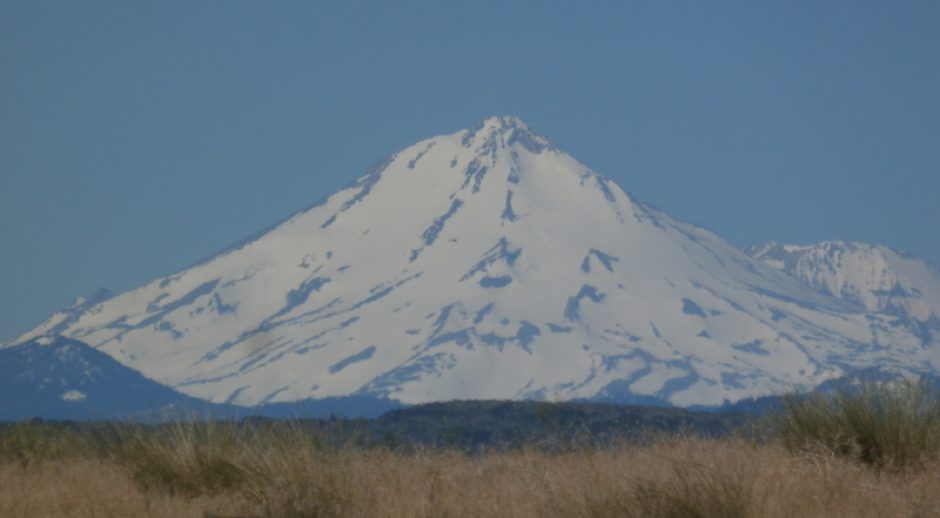
Anyway, I see now that I screwed up last time and put both the Dead Horse SP and the Canyonlands NP pictures in the same post. So I don’t have anything else to show except this video for sure was a panorama of the Canyonlands NP. You can go here to the last article to see the Canyonland’s photos.
And here is the video that shows a panoramic sweep of the canyons…
So that means no more pictures of canyons to show of that NP in this article. There will be more canyons as I head southerly on this trip to Amado, AZ and they will be in following articles.
Back to the story, as I returned to my RV that late afternoon, it was near 4 PM so I stopped at a quaint bar on the main drag through Moab for a beer and a rest. This is Woody’s World Famous Tavern.


And hey, it’s not bad as ol’ timey bars go.


It’s now a sports bar and has been here for decades, was once the most popular bar in town. Fairly nice. I understand that the bar used to be very rowdy. I learned some of the history when I was visiting by talking to the bartender, didn’t write anything down expecting to find it online when the time came, but now when I search, I find there’s precious little online. All I could glean was that Woody was a larger than life WWII vet who welcomed all into his bar, especially Vets.
I enjoyed my visit there, and saw it would make an excellent home bar for football, though there wasn’t much happening on a Tuesday afternoon when I came in. And after heading home, broke camp the next morning and traveled on to Aztec, NM.


Years ago I stopped there. It’s a hole in the rock. Won’t be stopping this time. But further down the road is this arch. See where that guy is standing…

I took a selfie there years ago and I would post the picture I took of myself up there but can’t easily find it here on the blog. I didn’t climb up there this time. Just didn’t feel in the mood for hiking. So, back on the road.

 You can see that the country has sort of flattened out. We are heading for the valley where the Animas River is. It’s farm country favored by settlers going back thousands of years. Farmington is now the anchor city in the area and Aztec is a suburb sort of. Smaller, nearby, but much older.


Horses! They shied away from traffic. Then there was the lonely oil derrick alongside the road. Eventually passed through Farmington, then a few miles later, by the Animas River until I reach my destination.


I paid for two nights here so I could visit the Indian ruins again, and branch out and visit some of the other sites nearby. I had spent a week here a decade ago but back then I only had a bike so didn’t go far afield. This time I have the car. First off, since the trip from Moab only took 3 & 1/2 hours, was visit downtown Aztec. I passed through on the way to Salmon Ruins and checked out places to hang out as I went.

 These first buildings I passed were built by a later settler, back in the 1800’s.


The name Salmon comes from the European settler who owned the land and this site for many decades. And it was he that built the buildings shown above.
And here’s a drawing of the grounds I’d be touring. Note that this is a drawing from the ‘Salmon Ruins Prehistory, History, and Research’ manual that I paid $3 for it and left a $2 donation. It’s worth the read. Info, drawings, and color pictures. The drawing has no attribute so I can’t mention the artist. Neither did the 2nd drawing. I put them here so you can have a sense of the ruins and grounds. The museum proper is on a hilltop overlooking the ruins. It’s around 100 feet higher. Which is why I drove down to the lower parking lot, because I’d neglected to bring my knee brace with me.
Click to access SalmonRuins.pdf
The ruins were built back in CE 1088-1090 and occupied until the grand migration of the pueblo peoples to the Rio Grande Valley around 1280 CE. After those peoples, the Navajo claimed this country as their own, occupying some of the abandoned ruins, but not these. These were left to decay on their own. But later, vandals and pot hunters damaged them repeatedly until ~1969 when the ruins were given to a local historical society and archaeological digs occurred under controlled conditions.
Click to access SalmonRuinsMap.pdf
The ruin’s were first photographed in 1874! And those pictures showed buildings of 3 stories which are pretty much fallen to ruin now.


The pot hunters and vandals really did a number on this site, like all the others. Good that it’s being protected now. I am endlessly fascinated by these old ruins. Trying to imagine how people lived and loved and worked here in these spaces. Most of them look rather uncomfortable, but I suspect many of the building designs were first made for protection, not so much for comfort.


First they build this village on a hill so there was a view of the countryside, than they got comfortable enough with the area and their neighbors they started building up, or they couldn’t trust their neighbors and so built look out towers. Three stories tall! All speculation on my part.


The long shadows are due to arriving late in the day, it’s late afternoon. Few people here today but some. The original Salmon homestead is just a few steps from the ruins. The entire family went to great lengths to protect the ruins from vandals and pot hunters over the decades, even filing a homestead claim on the land the ruins occupy. The family settled here in 1877.

 Wanted to show the masonry work so the closeups of the wall. Stones and mud mortar and shards of stone as fillers.


 The rock workmanship is top notch.
 And 21 is the last of the interpretative trail markers. Turn around and there’s the Salmon Family homestead. That might look line a fine dusting of snow, but actually it’s sandy soil.


Old stuff…speaking of old, my knees were getting a bit stiff and I jumped in my car and drove around the site a little. The roadway surrounds much of the homestead, borders the ruins, and skirts the west side of the museum up on the hill above. Initially, I parked up next to the museum building on the hill and paid the fee inside, then drove down to the lower parking area, so walking down then back up the steep hill to get to the upper parking lot wasn’t an issue.
Some of these out buildings are remains of later development and some built by the museum. This building is a replica of a Navajo hogan followed by a Ute permanent tepee.

 So that was the visit to Salmon Ruins proper. Cost was $10, then I paid $5 for the multi-page history, after I re-entered the museum building. They’re pretty relaxed there.


How ’bout that pottery? Beautiful. Anyway, after that tour, time to head back to the RV park. Got there at dusk.

Kind of cloudy too. No matter. Let my kitty outside to enjoy the new space.
 Next time we take a tour of the nearby Aztec Ruins site. One of the largest and best preserved Puebloan sites in all of the SW.
Thanks for reading!
Jim
Thank-you for sharing the ride…..I’m snowed in til April?
You are welcome. I would not be surprised if you are snowed in. Meanwhile, I’m enjoying the 70’s here in Tucson.
Jim, I am hoping to go out that way later this year if diesel prices will calm down. Are the main travel roads through the mountains from Wyoming down through Utah easy or are they high and curvy with no guardrail? Just trying to prep myself. It don’t take much to rattle us old Florida flatlanders.
I planned my trip to end up in Aztec, NM to revisit the area with a car in tow as the last time I was there I only had my bike. And after that, I had my eyes set on visiting Big Bend NP. So after Aztec, I took US-550 east to Cuba and that was the worst part of my journey this trip. It’s a nasty road and you can only travel at around 35MPH and often no more than 15 MPH. Because of potholes not because of steep drop offs or anything. That was supposed to be only a 1.5 hour trip and I tried to take a spur and drive my RV off the highway to Chaco Canyon to visit the ruins but that was a bad choice. Turned out that the road in was miles and miles of very bad unpaved road. I ended up back on the highway, then stayed in Cuba overnight where it got down to 20 F, so only stayed one night as my plumbing froze up. Anyway, that ONE SECTION of highway between Aztec and Cuba on the 550 was the only section that was no fun. And the times I’ve journeyed from Wyoming through Utah was all on easy breezy freeways that are in excellent condition. Not like some of the roads down south. Have fun, don’t worry about fuel prices as there’s nothing you can do about them.
I too have mostly stuck to freeways when passing through Wyoming. Neither I70 nor I80 are problems except if you don’t like big city traffic. I abhor I15 North and South through Salt Lake. I70 through Denver too. It’s not difficult geographically, but umpteen lanes of travel gets stressful after such a long stretch of it.
The I80 grade over the Wasatch is long with lots of speeding cars in the left lanes and trucks in the right one. I just stay with the trucks except uphill our C9 Beaver will pass them easy enough when no rocketing cars are imposing. Our Pak-brake easily spares wheel brakes on the long trips down, like from Denver to Salina, UT, or Park City to Salt Lake. Avoiding the S.L. section of I15 by routing via Ogden or Provo can cut a little more of the stress time, but so can driving it at off-peak hours, and studying exits and what lanes to be in ahead of time, and using a good GPS program.
Well said. I’ve not had a lot of trouble going through SLC over the years, or any big city for that matter, as I always plan my trips so I’m just reaching the city around 10 AM…no gridlock or heavy morning traffic. Takes some planning, but it’s doable. I do it when passing through any big city. If I can arrive sometime between 10 AM and 2 PM, very light traffic in general. The last few times through SLC were a breeze. Denver has that toll road that bypasses the entire city so I’ll be taking that from now on. Used it the year it opened and paid my $35 and was happy to do so. Very nice road. A visitor needs to know to go online and buy a pass though as none of the booths are open, they use cameras and your license plate and send you a bill. If they can find you. The first time through I had just changed home states so it took almost two years for them to bill me.
Thanks for the info. I really appreciate it.
A little late to answer this, but HEY, you are welcome. I hope you decided to visit Canyon NP. Fun.