I may have waited to long to publish this issue…but here it is. I’ll try to fill the empty spots in my memory with lots and lots of scenic pictures. How’s that sound?
After arriving in Moab on Nov. 9th, got settled in, found a nearby bar/restaurant/bowling alley that had recommendations galore so I would be able to watch the games I was interested in, and of course, drove around Moab to check things out. I initially paid for 2 nights at the OK RV Park but after perusing the internet for tourist activities in the area, I knew that wasn’t enough so I tacked 6 more days onto my stay for a total of 8 nights.
And since I’d arrived in Moab and settled in so early in the day, I unhooked the car and explored the nearby sports bar where I was able to watch a game and have dinner, then the next day…on a Wednesday…I headed for Arches National Park. I got there around 9:45 AM; I took this next picture at around 10:15 so I’d already been in line for 30 minutes. And still more to go. Only had to show my card and was waved through.
 And here I stopped on the slope leading into the upper area of Arches to take a shot of the entrance below.

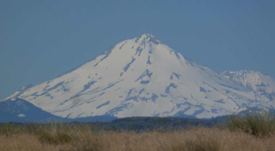
Here is a shot of the other side of this giant rift canyon where Moab is a few miles to the south. That western side is 2600 feet higher than the eastern side I’m on.
 And here’s the NP service map I was using to navigate the park.


 Lots of big ass rocks! Fascinating.


Yes, I did stop at these many trails in the park and walk them. As I’ve mentioned in years past, I find rocks and geology to be endlessly fascinating. If I hadn’t been enamored of electronics at a young age, I likely would have pursued a life as a geologist, perhaps with a minor in archaeology. But, things happen and I ended up loving my life in electronics. Geology and archaeology are distant, neglected hobbies now.


Some pretty cool pictures. Really an interesting place to roam around. I definitely would NOT want to be here in the summer though.


 Kinda cool ‘ship rock’ sorta landmark used by settlers as they passed though the area.


 This fallen arch (series above) was kind of interesting. Hard to see exactly where the massive main part ended up but I suspect it’s in this pile of debris, though that hardly looks to be enough material.
And here’s a close telephoto of the base of the bluff. I think those holes are bird nests chipped out over the centuries.

And then finding an open area…


That area is by this time several miles into the NP, the road is a long up and back that passes by all these ‘sites’ that have some geologic or historic import. And there are a couple short excursions off the main road. You can see where people have in the past turned off the road nearing some interesting view point so the NP service made them official. Occasionally you’ll see where a new used and abused area is being trampled by hordes of tourists and their vehicles but it’ll not be long before the NP service has it protected again. Usually by making it an official turnout spot with paved parking.


 Obviously, those in the know would call this penis rock. It’s not marked by the PS but, come on, we all know that’s what they call it.


 Check out this next pic of a balanced rock. Pretty cool…


And look here, finally, an arch or two! And then arches galore, and then other stuff!


 L
L


Each of the above pictures were taken from an arch viewpoint. Then I got to one where you could walk up to and under the arch. This was another tour I’ve taken where I said to myself that I need to get me some hiking sticks. My knees were doing fairly well on this tour but, it did get a bit steep on the way to the arch so…and here’s where I was heading. Note that the trail is kind of primitive in some areas and/or steep, but passable.
 And before reaching the arch, stopped to take some panorama shots around the area.


You can see above that it’s a 1/2 mile or so hike from the parking lot. Getting closer!


And then I was standing on the platform under the arch thinking it would be a great place for a Starbucks after walking all that way wishing I had a cappuccino.


I took that one shot straight up into the bottom of the arch. Has a giant crack in it. Won’t be long before it crashes down, crushing any Starbucks that might have built there. And then I returned to the parking lot forgetting to get a shot of the PS plaque telling me which arch that one was I just visited. But the next stop, that’s the first shot I took…and then I hiked up the trail to the arches.


I liked that arch setup too. They last two stops have both been cool in my opinion. Now that I think about it, I should have taken a few panoramic movies of the areas I was stopping at. Dammit, didn’t think of that.
 And here I am being all smug about being here. Note it was cool enough that I needed the hat and the long sleeved shirt. But I did wear shorts and had sandals with socks on.


Neat looking set of arches. I could have climbed up underneath the first arch but didn’t want to. Sun was so bright I couldn’t tell if the first pic I took of myself turned out, so I did a second. I was tucking my chin down so my neck flares out like a dinosaur.


Pretty soon I entered this striking layered sandstone area. The colors are bright and vibrant, as you can see. 
But this place really is much more impressive in person. And probably even more impressive at dawn or dusk.
And then the road took us near these open vistas and I felt compelled to take pictures. Cus that’s what everyone else was doing.


Remember ‘Penis Rock’? Well, here are the balls. HAH!


Quite the area isn’t it? And here was another trail that looked interesting and as I parked and exited the car, this raven decided he wanted to talk me up. I told him I didn’t have any food so he just eyeballed me. The blue ball is in the background. This stop was a hike to…well, you’ll see.


 Yep, that’s right, it’s a slot canyon with the added bonus of having a hidden arch later on the trail.


And here we are at the arch. Sun was just starting to turn everything golden in this slot canyon. Nice and coolish in here. The sign at the entrance to the slot even mentioned that this canyon was a favorite place for mothers to rest their children and get them out of the hot sun (in summer).


A few miles later are these dome things.

And then checked out this overlook…place was so crowded that I just drove on after I found that it’s a hiking trail jump off point. Delicate Arch I think, or some other arch that needs a long trail to visit. So basically nothing to see here, you’ll have to hike some miles to see a hidden arch.


I did like the ‘sentinel’ rock formations though. And then down the road a piece there is this bright white colored rock sitting on yer typical brown rock. Oh, and some trees! Likely a spring in the valley higher up too. Creek bed lower down the hill was a tad dry though.

 I believe this is Delicate Arch off in the distance. I wasn’t that far from the trail jump off point and it was too far for me to walk so I’ll just have to be satisfied with this picture.

I thought there must be a lot of water in this tiny valley from all the greenery, and then here was some water lower down. I’d imagine it was coming from a spring from the water that went underground further up the hill.


And then I visited the RV park that’s way up there in the furthest reaches of the park. Interesting but a dry camp, no cell phone service, no anything for RVs really, well, here, read it yourself: Camping – Devil’s Garden Camp
After the entire drive, ending at Devil’s garden, it’s a tiny loop there through the RV park if you wish, than 18 miles back to the entrance. There had been two side excursions where I’d drive to a jump off point and then hike to the attraction. By the time I finished visiting the campground, I was pretty tired so just headed back that 18 miles to the entrance and then home, plopped into my recliner, and pet the cat. Did stop to take this last photo of the entrance to Arches NP, and the next two from the car. Way off in the distance is Moab. Even further along is where I was staying.

But before I got there, this is within a mile of downtown Moab as I was driving to the RV park. Just the one deer though so it was probably heading for a bar to find it’s friends.


So that’s it for Arches NP. Took nearly all day to tour the loop and stop at nearly every stop the NP service had laid out and improved with blacktop and trails so anyone can do Arches in one day. There’s much to see other then Arches nearby too so plan on visiting for a couple days at least.
Thanks for reading!
Nice pic’s. Very nice area indeed. In that photo just below the “penis” rock on right side about 1/3rd the way up of that rock column my eyes see the profile of an African older man. Especially the eyes, nose and jutting jaw. Wonder what others think.
Thanks, Paul. Yes, it was a very nice place to visit. In winter. I would stay very far away in summer, I could tell how hot it must be in August.
Yes, I see what you’re talking about. There was another rock that looked much like an Indian in profile and full headdress but can’t find it today.
Edit: in the photo just below “penis rock foto.
Yeah, found it…
We scored 3 nights at Devil’s Garden Campground. It is dry camping, with incredible views of the night sky. Your blog gives a great overview of the highlights of Arches.
Good to hear your knees are doing much better.
I was thinking that about the night sky when I drove through that it would be a really cool place to star gaze. Good for you for reserving your spot up there.
Yes, my knees are doing fairly well. Not as well as a 20 yo mind you, but pretty well.
Thanks for the tour..Maybe someday I’ll make it…
You are welcome! I really enjoyed it there.
A “great place for a Starbucks”??!??!??!??!